AYURVEDASUBSCRIBE to the NEWSLETTER!
Coffeytalk on Facebook
Coffeytalk on Twitter
Coffeytalk on Youtube
Coffeytalk on Instagram
Coffeytalk on Amazon
Coffeytalk on Spotify
Lissa Coffey on Vibe
Lissa Coffey Podcasts on iTunes Connect
buttonlayer2
28 May

Remembering Memorial Day 2010

Three years ago, I had the opportunity to participate in the Memorial
Day walk at Valley Forge National Historical Park in southeastern
Pennsylvania. Valley Forge is where General George Washington set up
winter camp in December 1777 while the British army under General
William Howe occupied Philadelphia (and the Continental Congress headed
west to Lancaster and York). This wasn’t my first visit to Valley Forge;
in fact, I almost worked there as a seasonal park ranger during the
summer of 1991 while in graduate school (but I had a better job offer
closer to home), and I have visited there many times. This trip,
however, would be different for a variety of reasons, most notably that I
learned something new (which at this point doesn’t happen often when I
visit historic sites related to the American Revolution) and that it led
me on an adventure that summer that included visiting a total of eight
(or nine, depending on how you count) historic sites related to the
American Revolution.

My first visit to Valley Forge was in the summer of 1978, when my
family traveled to Pennsylvania from Houston to visit relatives, and,
since we were in the neighborhood, we stopped at Valley Forge before
heading to Philadelphia. The next time was when I was a graduate student
at Penn State and accompanied the History Club on a trip to
Philadelphia, one that was led by my advisor, who had attended graduate
school at the University of Pennsylvania (and knew Philadelphia like the
back of his hand). Throughout the mid-1980s, I visited the park several
times on my days off when working at Hopewell Furnace NHS, including an
opportunity to observe the reenactment of the Continental Army’s
departure from Valley Forge in June 1988.

Each time I visit the park, I learn something new, whether it’s about
the construction of the log houses that replicate where the Continental
Army troops lived during the winter of 1777-1778 to soldier life to
details about Martha Washington’s visit to the camp that winter. The
park has changed a bit since my first visit 35 years ago, with new
exhibits in the Visitor Center and new wayside signs around the park.

Muhlenberg huts...replicas of the types of structures inhabited by the Continental soldiers

Muhlenberg huts…replicas of the types of structures inhabited by the Continental soldiers

Interior of Muhlenberg huts.

Interior of Muhlenberg huts.

Display case including medical instruments

Display case including medical instruments

Unfortunately, the bears were long gone, or they would have become dinner.

Unfortunately, the bears were long gone, or they would have become dinner.

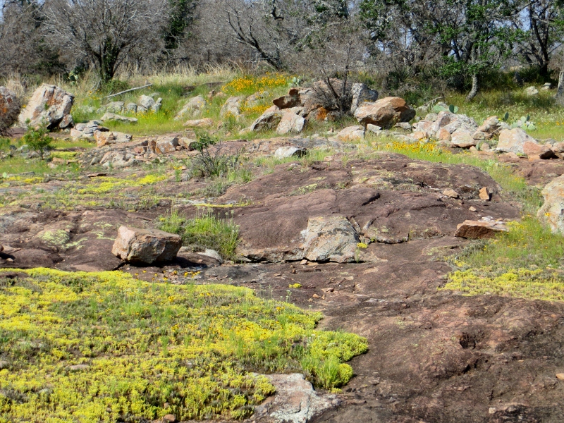
The purpose of the Memorial Day walk, according to the ranger who led
it, was to commemorate the troops who had served in the Continental
Army during that winter. We followed the Joseph Plumb Martin Trail,
named after one of the Continental soldiers who was part of the
encampment and who often went out on foraging expeditions to gather food
for the troops.

Signage for Joseph Plumb Martin Trail.  I'm sure the Continental soldiers would have enjoyed skateboarding, even though it's forbidden.

Signage
for Joseph Plumb Martin Trail. I’m sure the Continental soldiers would
have enjoyed skateboarding, even though it’s forbidden.

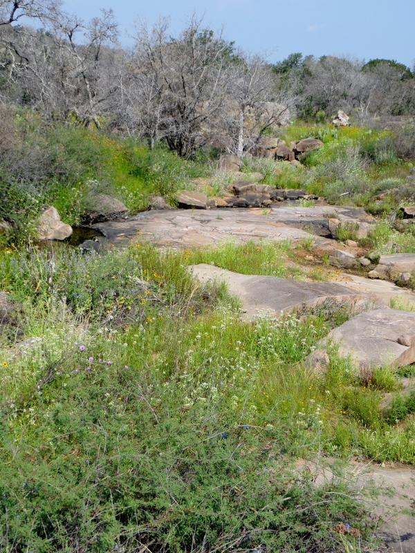
The walk went from the Visitor Center to the Memorial Arch and back,
with stops at markers to lay wreaths and flowers to honor the soldiers
who served (and perished) during the encampment.  On the return, we were
allowed to walk at our own pace…and, in the process, stop and observe
some of the reenactors who were demonstrating drills and camp life
during that winter.

Reenactors outside Muhlenberg huts.

Reenactors outside Muhlenberg huts.

Marker for General Nathanael Greene's troops that camped at Valley Forge.

Marker for General Nathanael Greene’s troops that camped at Valley Forge.

Washington Memorial Arch.  This was not present during the encampment.

Washington Memorial Arch. This was not present during the encampment.

She first pointed out that the legend of “bloody footprints in the
snow” really was not accurate, as the soldiers did have shoes—but they
were worn. In addition, more soldiers died of disease in the spring, as
influenza, typhoid, and dysentery spread through the camp between March
and May.  The winter was actually warmer than usual, allowing troops to
begin training under the leadership of Baron Friedrich Wilhelm Augustus
von Steuben, a former Prussian military officer who drilled the troops
in the European style of fighting (which led to the Army’s victory at
the Battle of Monmouth Courthouse in June 1778).

Type of signage...in this case, in front of a statue of George Washington outside the Isaac Potts House

Type of signage…in this case, in front of a statue of George Washington outside the Isaac Potts House

Isaac Potts House, also known as Washington's Headquarters.

Isaac Potts House, also known as Washington’s Headquarters.

Stables outside Washington's Headquarters...yes, the horses had better housing than the soldiers did.

Stables outside Washington’s Headquarters…yes, the horses had better housing than the soldiers did.

In fact, according to the ranger, the devastation attributed to the
Valley Forge encampment actually is more accurate for the winter camp at
Morristown, New Jersey in the winter of 1780-1781…and thus began my
vision for what I refer to as the American Revolution Magical History
Tour, during which I visited eight state and national parks that
included the War for Independence as part of its interpretive focus.

Share this
21 May

Inks Lake State Park, Texas

San Antonio Hill Country Hikers came through again with another fun
day. Bob and I left San Antonio at 7:10 a.m. and drove to Inks Lake
State Park two hours directly north of us.

State Park
Hwy 4 west from US 281 is a roller-coaster of a road, literally. As you
crest the first hill, you can’t see the bottom of the road. It is very
steep. The road goes up and down a number of times, not to mention the
tight 35 mph curvy section closer to the park entrance. Vehicles towing
RVs and boats beware!!

At
the park entrance gate, we showed our state park pass and were given a
vehicle window sticker for day use. We located the parking lot at the
trailhead and waited for more people to arrive.

Twenty people later we were off,
walking at a good clip along the green trail to Inks Lake. The
highlights of this hike were the wildflowers, the trails, lake views,
expansive granite outcrops and the cacti. However, there are a lot of
exposed areas, i.e., no shade. If you plan to hike here, be sure to put
on sunscreen and take lots of water! Start as early in the day as
possible if the temperature is going  into the 90-100 F. range.

Bob ready to roll.
Prickly pear and brown-eyed Susans.
Paul leading the pack.
Pink granite and yellow stonecrop.

The geology around Inks Lake dates back millenia and showcases
pre-Cambrian pinkish granite-like metamorphic rock called Spring Valley
Gneiss which was formed from re-crystallized sedimentary rock. The
sparkles in the rock come from feldspar minerals. Throughout our hike,
we crossed large areas of gneiss with the lovely little yellow stonecrop
succulents living in the vernal “pools.” These succulents thrive in
limestone, sandstone and granite. The yellow stonecrop lives in the
vernal (spring) depressions in the rock to absorb and use moisture
stored in the pools.

Yucca fireworks (with brown-eyed Susans).
Yellow stonecrop.

The trail is rated moderate. You must keep an eye out
for rocks and roots on the trail. Hiking poles would be a good trail
aid at this park.  The
view of Inks Lake was great from this viewpoint.

Find your own way to the top.
 
View of the lake and dam from the top of the granite hill.

Here are photos from the first part of the hike.


Hill Country Hikers hitting their stride.
I want to go there, and we did.
Lovely wildflower (rose gentian/Texas star) all by itself.
Texas paintbrush (Castilleja indivisa)
Inks Lake State Park landscape.
Bull nettle (Cnidoscolus texanus)
The trail wound up, around, over, down, and through rocks.
Cool rock.
I wasn’t kidding about lots of rocks!
 
Spotted beebalm (Monarda punctata)
 
 
Pencil cactus with bright red berries.

If you ever watched the old TV series, the Addams Family, you will recognize the following…

Cousin Itt cactus (my name for it)
More Inks Lake landscapes.
Natural xeriscaping (dry landscaping).
This cactus is cheering for us, “You can do it!”
I LOVE this little cactus. The star design is gorgeous.
The brown-eyed Susans were up to our thighs.
Hey, for once I’m ahead of the pack!

With 5.9 miles under our belts, we drove to another
part of the park for a picnic lunch and a one mile hike to Devil’s
Waterhole swimming area. The weather was hot and humid. Bob could hardly
wait to get in the swimmin’ hole. I sat in the shade, took photos, and
avoided ants and mosquitoes.

Visitor to our picnic area.
Lizard on the rocks.
Winecup flower under spotted beebalm.


Swimming hole, too stagnant for Bob and others in our group.
 
Scenery by the trail. Our group did not swim here.
Bob negotiating the rocks at Devil’s Waterhole to climb higher.

Bob said the rocks were very slippery! He had to be very careful.

As
you can see in the photo below, Bob enjoyed the jump into refreshing
lake water. After Bob’s first jump, a large group of people arrived who
were drinking beer, smoking and being obnoxious. The young men of the
group climbed to the top of the large rocks and leapt out over the lower
rocks for more of a rush. I’m happy I did not witness anyone hitting
the rocks on their way down! We left shortly after.

[An
aside: At some Oregon swimming holes, people die or become quadriplegic
after hitting rocks trying to jump from too high. One swimming hole in
Oregon, High Rocks, had to close to public swimming because drunk people
were climbing the trees on the cliffs and trying to jump out far enough
to miss the rocks. If they didn’t hit the rocks on the way down, they
hit the rocks under the water. Sad.]

People jumping from the rocks above where most people dive. Bob is 6′ tall, so we can guess these taller rocks add another 20′ in elevation to the jump.

Photo below is Bob jumping from the safer (lower)
height. To the left in the photo, you can see the edge of the bottom of
the rocks above.

Bob launching himself into the air.
Bob hitting the water (bottom left).

Okay kids, don’t try this at home. Bob grew up in
Hawaii and has been jumping off cliffs into the water since he was seven
or eight years old.

With Bob refreshed and
reinvigorated, we headed about a quarter mile back to the car and called
it a day. As we drove toward US 281, we stopped so I could take a photo
of a castle on the hill. We had no idea what it was, so I Googled it.
You can read about Falkenstein Castle here.

The photos on their website do it more justice.

Bob wanted to know how Inks Lake got its name so I
Googled that too. Inks Lake was named for Roy Inks, a Llano businessman
and mayor, who worked on funding to build a dam on the Colorado River to
provide power. The funding of the dam became an obsession for Inks
which resulted in him being named Director of the Lower Colorado River
Authority (LCRA). He died before the dam was completed. Because of his
efforts in securing monies for the dam, the lake was named after him as was one of the dams.

Travel Bug out.

Share this
14 May

Government Canyon State Natural Area, Texas

Bob and I went our separate ways this morning. He ran 10 miles on the
Riverwalk, and I hiked five miles at Government Canyon State Natural Area
with Hill Country Hikers. Both of us enjoyed our respective forms of
exercise.

The hiking group started at 8:00 a.m. and we
did five miles in two hours. Quite a few new hikers joined in today. I
think we had about 15 people. Today’s hike was a walk in the park –
mostly level, easy trails with just a few rock and root trippers.

Hiking down into the canyon.
A portion of the canyon floor.


Brown-eyed Susans and blue-star
Bunny frozen in place.
Prairie larkspur and firewheels.
Government Canyon State Natural Area – A path we didn’t take.

Another 2.5 mile hike was next on a different trail in the park. We
could opt out of the shorter hike and three of us did. After 8.8 miles
yesterday, I felt five miles was enough for today. My feet thanked me
profusely for not adding blisters.

Travel Bug out.

Share this
14 May

Colorado Bend State Park, Texas

It’s time to catch up on this week’s events, now that there’s time to
catch my breath…literally.

The
Hill Country Hikers group I joined on meetup.com is terrific. We have
met so many great people who love to walk, hike, and enjoy being in
nature.

Saturday morning Bob and I got up early to meet
Hill Country Hikers for a day trip to Colorado Bend State Park. The
drive each way was over two hours from San Antonio, Texas, but well worth it. We enjoy hikes in
the parks so much we bought an annual state park pass. But I digress.

We stopped to get a couple of photos on our way to the park…

The morning sun made these firewheel flowers look translucent.
We crossed this on the way into the park.

About 25 people showed up for the walk. Some made a
weekend of it and camped in tents in the group camp area. We met up at
the trailhead for Spicewood Canyon Trail and off we went.


Colorado River
Hill Country Hikers
Our trail environs.
Bob keeping an eye out for rocks.
Fields of brown-eyed Susans
Very rocky terrain
We crossed streams on stepping stones..carefully!
Paul, our leader, taking photos.

As you can see this area is lovely. Tinkling water
kept us company when we reached the bottom of the canyon. We did not see
Spicewood Spring, but we enjoyed the creek that is the result of the
spring. Downriver from where we entered the canyon we came upon a
popular local swimming hole.

Rock on – necessary to watch trail at all times!
Swimmin’ hole on a Saturday afternoon.

At the end of the Spicewood Canyon/Spicewood Springs
Trail, we joined the group campers at their site for lunch. The hikers
had brought their own lunches, but it was nice to share the large picnic
table for family-style conversation…although we were so hungry, it
was quiet while we ate.

When Paul was able to drag us
away from our after-lunch chats, we drove caravan-style in seven
vehicles to the Gorman Falls trailhead for the second part of our day
trip. Again, the trail was rock strewn or just plain rock.


What a day! 81 degrees.
Rock trails in many places.
Prickly pear cactus blooms.
Quite a climb down to the falls.

Even worse going back up!

From the Colorado Bend State Park map, copyright 2012 Texas Parks and Wildlife Department:

“Gorman
Falls is a unique geologic formation that supports a sensitive
ecosystem. The mineral rich spring water deposits layers upon layers of
delicate calcite, slowly building up the travertine formations you see
here…”

This is the type of formation you would see
inside a cave, only it is outside; similar to the travertine terraces at
Mammoth in Yellowstone National Park. Seeing the amazing formations was
a highlight of today’s hikes.

Gorman Falls calcite in travertine formations.
Bob soaking in the negative ions from the waterfall.
This tree loves its location by the falls.

Hiking back up the rock wall required strong thighs,
ankles and legs. Our hearts were pumping hard and it helped to step to
the side of the trail and breathe deeply for a few minutes to recover,
then carry on. We were on our way to see Gorman Spring – the source of
Gorman Falls.

Gorman Spring Trail – cool tree
Bob and Susan on Gorman Spring Trail.
Gorman Spring pool
Cottonmouth water moccasin hiding under brush in Gorman Spring pool.

Only its tail is visible.

Looking downriver from Gorman Spring.

From the spring we hiked back to a maintenance road
then on to our cars. That was the end of our group hikes. Bob and I said
our good-byes.

We made one stop at Dairy Queen in
Llano for Blizzards, then headed off to the Willow Wildflower Loop Drive
to see if wildflowers were blooming in May. We found some. In fact, it
looked like there was a new crop of bluebonnets coming up.

Verbena
Silver-leaf nightshade
Willow wildflower loop drive.
Roadrunner
Turtle
Firewheels

It was time to head for home – tired, but energized from 8.8 miles hiking.

Movie review:
“The Incredible Journey of Mary Bryant,” starring Sam Neill and Alex
O’Laughlin (of Hawaii 5-0 fame). The movie came out in 2005. This is a
historic period piece, based on actual events, that takes place in 1788. A
young Englishwoman is accused of petty theft. Her punishment: to be
banished to Australia, on one of the first 11 ships, to start construction
of penal colonies to house criminals from England. The  movie is over
three hours, but is so interesting it doesn’t feel that long. The living
conditions on the ships and in Australia are deplorable. You wonder how
anyone could live that way. Escape plans are hatched and carried out. I
give this movie four out of five stars. We rented it from Netflix.

Travel Bug out.


Share this
14 May

Walkabout Two-fer, Part 2

Part 2: Bob joined me for our San Antonio Hill Country Hikers Urban
Walk in the King William District and along the south Riverwalk to
Roosevelt Park. We started at 7:00 p.m. and headed south from the Blue
Star Brewery area along the south Riverwalk to Roosevelt Park. Eighteen people
walked this evening.

Crossing the San Antonio river.

You never know what you will see. I like the way the following homeowners think. See photo below.


San Antonio River

Most of the people walked past the heron below. He
was as still as a statue about
four feet from the path.

Yellow-crowned night heron.
San Antonio River Flood Control Tunnel outlet.
Snowy egret


Urban hikers crossing the San Antonio River.
Yellow-crowned night heron.
Where our walk went.
San Antonio River south.
Lighted gazebo in an estate’s backyard.
Snowy egret at night. Still fishing.

The Hill Country Hikers walked at a moderate pace
tonight, not the “fitness hike” pace of last Friday night. I still had
to run to catch up when I stopped to take a photo. Wait a minute! I
don’t want to be a runner, but I’ll sacrifice for a good photo. Jasmine
bloomed along the trail so we had pockets of sweet jasmine perfume as we
walked.

The temperature was just right at 72
degrees, but it was rather humid. The good news is there was a very nice
breeze blowing so we didn’t get too sticky. Total miles for this hike:
4.5.

Total miles I hiked today: 10.7.

Our
hike finished at 8:25 p.m. Bob and I walked across the street to La Tuna Grill where we had fish and chips for dinner.
I had a Corona with lime and Bob had a Modelo beer. The grill had the
Spurs play-off game on HDTV. Very good.

Travel Bug out.

Share this
14 May

Walkabout Two-fer, Part 1

What a day I had! I was busy from sun up ’til sundown. Bob made sure I was up and at ’em at 6:00 a.m.

My
first event was a 10K (6.2 mi.) walk for American Volkssporting
Association’s (AVA’s) World Walking Day. The local volkssport club
staffed registration at Crownridge Canyon Natural Area starting at 7:30
a.m. Because of heavy rush hour traffic, I got there at 8:10 a.m.

The
first 5K of today’s walk followed the loop hike through Crownridge
Canyon and the second 5K went through The Heights residential area in
the hills northwest of San Antonio. I love walking through the woods.
You never know what you’re going to see. Today’s prize sighting was a
pair of painted buntings. I also saw four wild hen turkeys. Not bad.

Unusual flowers on this vine. Anyone know what it is?


Rain lily with pale green spider on the lower left petal.
Beautiful red seed pods.

Yes, the volksmarch took us on the Level 4 part of the natural area – the Upper Canyon Trail.


Upper Canyon Trail
Upper Canyon Trail

I’d like to mention that San Antonio is very focused
on putting in parks and greenways. It’s a good thing they provide
natural areas. You can see in the photo below how the new homes are
coming right up to the edge of the natural area. Many of the hill tops
have active home construction projects.


Painted bunting.
Painted bunting. I had to zoom in to get these shots.
Painted bunting’s back colors.


Fields of firewheels (Indian blankets).

That ended the first 5K of this morning’s walk. From
the natural area, the walk followed city streets up into a very nice
neighborhood (at the top of the hills).

Exiting the natural area on foot.
Hen turkeys.
Magnolias in bloom.
Cacti in bloom.
Beautiful snapdragons!
Coral bean plant.
The Heights neighborhood.
Beautiful pottery on the porch.
Honeysuckle in bloom all over!


This blog is long enough. I will continue my walk-about two-fer in another blog.

Travel Bug out.

Share this
06 May

Walk with San Antonio Hill Country Hikers

Such an exciting day today! And it’s all good.

Yesterday
I joined four meetup.com groups and this evening Bob and I went on our
first walk with Hill Country Hikers. We met at Robert Tobin Park where
we started our four-mile round trip at a moderate-fast pace. We walked
15-minute miles, so we finished in one hour! Fourteen walkers showed up.
What a nice group of people. One lady, Vanessa, brought her Husky,
Amanda.

The park sign behind me is faux bois. See

explanation below.

At
exactly 6:45 p.m. we started south on the trail through the Salado
Creek Greenway. This is a beautiful trail with lots of trees and the
wildflowers are still blooming. Because of the recent rain, everything
was green and growing. Paul, our leader, told us the south trail from
the main parking area is excellent for summer hiking because the trail
is shaded…a very good thing when temperatures hover around 100 degrees
F.

Paul, our walk leader.

Before we started the walk we had time to
read the plaques. Robert L.B. Tobin, after whom the park is named, was
born in 1934, educated in the Alamo Heights (San Antonio) School
District and attended the University of Texas. His father died in an air
crash in 1954. Robert took over leadership of the family business,
Tobin Surveys, Inc. He built the business into the nation’s largest
mapmaker for the oil industry.

Also on the park entry signboard was information about faux bois
(false wood) or “trabejo rustico.” At the parking picnic area all the
tables, benches, the park entry sign, and support for the signs are faux bois. What is faux bois?
It is a craft that was popular in the late 19th century to the 1940s
which is experiencing a resurgence. Natural elements such as wood,
thatch, vines and branches are recreated in concrete. The faux bois pieces
in Tobin Park are the work of Carlos Cortes, a third-generation artisan
whose great uncle Domingo Rodriguez brought the skill to Texas from
Mexico in the 1920s. Other Cortes family creations around San Antonio
can be seen along the Riverwalk (especially The Grotto on the north
Riverwalk), at Brackenridge Park, and some bus stops.

Faux bois picnic table.
Faux bois bench.

Here are photos. I took only a few because if I stopped, I had to run to catch up. Some photos were taken while walking.

Salado Creek Greenway trail.
Mexican hat wildflowers.
Walkers on the trail.
Coming up to our turn-around point with Paul in the lead.
Great egret in Salado Creek.
Salado Creek Falls (ha ha)
Salado Creek
A very large, old pecan tree.
Honeysuckle growing along the trail. Smelled wonderful!
Rain lily. Only bloom for three to four days after rainstorms.
Bluebonnets – some going to seed.

The sun was out, birds were active, the air was fresh
and clean after our recent rains. The temperature this afternoon was
perfect at 72 and very low humidity. At the end of our walk we felt
great.

Travel Bug out.

Share this
06 May

Hiking Fools

What do you call a group of people who love to hike, make silly puns,
sing a few bars of whatever song happens to pop into their heads, and
play pranks on each other? Hiking fools (AKA San Antonio Hill Country
Hikers).

Sunday morning I dragged myself out of bed to
make the 8:45 a.m. start time at O.P. Schnabel Park Trailhead in
northwest San Antonio. The park is part of the Leon Creek Greenway.

Meanwhile, Bob did a ten-mile run on the Riverwalk from our RV park into downtown San Antonio and back.

Once
again our hike leader, Paul, took us on a mostly shaded hike. Did he
stick to paved trails? Nooooo. He must know the park like a truck driver
knows interstates. He had us traipsing through the woods on deer
trails, gravel and rocky paths, over the “river” and through the mud.
But we didn’t end up at grandmother’s house. We ended up right back
where we started 5.7 miles later. Thankfully in the description of the
hike, Paul told us to wear hiking boots or sturdy shoes. Especially nice
to have on my boots for the steep rocky section of trail and for the
mucky mud.

The heavy rain we had last week created more
than mud. Wildflowers bloomed, grasses sprouted seeds, and the trees
were vibrant green.

The hike wasn’t the breakneck pace
of last Friday evening’s Tobin Park walk. Today we took time to smell
the blooming sage, look at deer who were looking back at us, and take
pictures. In honor of Cinco de Mayo, one guy broke out singing “La
Cucaracha.”

I am amazed by the variety of scenery in
San Antonio and that we keep learning about new places to be out in
nature. The locals on the hike talked about how much they like San
Antonio’s greenspace initiatives and vote for them whenever they are on
the ballot. The greenspaces are well used by animals, birds, and people
in the region. We saw many deer on our hike. The mud revealed tracks of
deer, raccoons, people and dogs.

Runners with marathon
numbers were on some of the paved trails. We were told they were running
a half marathon. It must have been very popular because when we
finished our hike the runners were leaving. Police had to direct
traffic; the start/finish of the half marathon was across the main
highway from the park we were in.

Surprise, surprise: I have photos from the hike today. Don’t I always? Here they are…

Wooded glen.
Most times there is no water here.
Rain lilies.
One of the many deer checking us out.
This huge rock wall reminded me of a hike we took at the Ledges

area in Cuyahoga Valley National Park in Ohio.

Our hike leader, Paul, said there usually isn’t water here. All of us were impressed by this pretty, seasonal “lake.”

Instant lake, just add water.
Wildflowers on the rocks.
Isn’t this inviting?
Check out those roots!
Egyptian goose.
Paul talking to Kim, Carmen and Eduardo.

Paul capturing a moment.

Can you say “spring cleaning?” That’s what we did all
afternoon. It was way past time to clean our 5th wheel carpets so we
rented The Rug Doctor machine from WalMart and Bob, bless his heart,
made many passes of the carpet cleaner over all the interior carpet.
When he had done enough, I took over and made a couple more sweeps of
the living room carpet. It looks so much better!

Sunday night TV is 60 Minutes and Amazing Race.
We finally sat down and relaxed with dinner, then later with a bowl of
ice cream and cookies. Well deserved. Thank you, honey, for being the
“heavy lifter/ muscle” in the carpet cleaning. It’s so nice to walk on
the carpet now.

So ended our second busy weekend day in a row. Even the cats are exhausted!

“I wanna hold your hand paw.”
We love each other.
The end.


Share this
29 Apr

Cascade Canyon, Grand Tetons, Wyoming

(From August 1, 2012)   Last
night I was re-reading my blog from Cascade Canyon above Jenny Lake in
the Grand Tetons of Wyoming. I was aghast. Where were my photos?
Something was amiss.

After
re-reading the blog, I went, “Oh, yeah, I remember, we didn’t have
internet connectivity for any length of time and I posted I would
complete the blog and add photos ‘in a week or so.'” Well, blogger
friends, this is “the rest of the story,” as Paul Harvey used to say.

Please refer to my blog dated August 1, 2012 — 9.3 Miles, 1,100 ft. Elevation Gain for the segue into this.

We
had a wet boat ride across Jenny Lake, luckily we snagged a seat under
the cover of the boat. By the time we arrived at the trailhead, the rain
had stopped. That was the last rain for the day!

This blog is going to be loaded
chock-full with pictures. Cascade Canyon is awesome and by far the most beautiful hike of all our Grand Teton/Yellowstone hikes.

The
first half mile took us uphill to Hidden Falls. Along the way,
novice rock climbers stopped to learn basics about climbing up
smaller rocks. Hidden Falls and Inspiration Point, both on
this trail, are the most popular destinations in Grand Tetons. We
expected the crowds at the lower elevations of these two destinations.
We were able to get uncluttered photos and even had willing
photographers to take a photo of us, together for a change. I should
mention that wildflowers are at their peak in early August. Love!

Our last-minute campground–spent three nights. Mwah! Beautiful.


Early morning overlooking Jackson Lake and the Grand Tetons.


Grand Tetons, early morning, shot through the car window.

Click photo to enlarge photo to see rainbow to right of mountain.

Fireweed. Wildflowers in bloom everywhere.

Bob & Susan — Hidden Falls

Hidden Falls close-up.

My favorite picture of me from today.

Tall Jacob’s Ladder and some kind of berry.

An early preview of our scenery on today’s hike.

From Hidden Falls, the trail moved steeply upward, across a rock wall, to Inspiration Point. 

This
is as far as most people go, so it was crowded here with sightseers from the boat. Once we passed Inspiration Point, the crowds thinned
dramatically. The trail also leveled out and was a gradual grade for the
next 3.5 miles.

What a lovely day. No more threat of rain, although we
heard thunder one more time as the storm moved off to the east.

At this
point, pictures can do the “talking.” Just a few captions and notes
about what we saw. 

This is Cascade Canyon–words barely do it justice.

Majestic mountains.

[Note: If you want to see moose, come to Grand Teton National Park in
early August and hike the Cascade Canyon trail at 9:00 a.m. This first
moose (three photos) was about 10-20 feet from me right next to the
trail.]


Ummmm…just
when I decided to cross the trail in front of the moose, he decided he
wanted to cross the trail. Oops. You eyeballin’ me boy? Let me get out
of your way!


One gorgeous scene after another.

Bob took this fantastic photo. Great composition!

The following photo
was taken to show the scale of the mountains. You can barely see Bob
walking in the bottom center of the photo!

Can you find Bob?

This is called Cascade Canyon because of many waterfalls that come down off the cliffs into the canyon.


Reflecting, still pool in the river.


Craggy Grand Teton peaks.

Mountain splendor.

A waterfall coming off a glacier.

Butterflies love the wildflowers in the area.

Smooth (or showy?) fleabane.

Wyoming paintbrush, leafy aster, yarrow.

Woolly fleabane, smooth fleabane, Wyoming paintbrush, common harebell

Lewis’ monkeyflower (named for Meriwether Lewis!)

Lunchtime…good spot to eat our apples and trail mix!

Moose #2: Classic moose pose–standing in the river
while eating. (We saw a total of three moose on this hike. The last
moose was lying down in the shadows surrounded by six people. I opted
not to try for another photo.)

Someone on the trail said: “Go look over the side of that rock.” Moose #2!

Riders resting their horses allowed me to photograph them.

Another waterfall…this one on the main river through the canyon.

Our happy feet in comfy boots.

A pack train went by, made a stop at the cabin; our turn-around point.

It’s downhill and gorgeous from here.

Grand Tetons and an area of rockfall.

Bob at Inspiration Point, overlooking Jenny Lake.


As soon as Bob sat
down on a rock at Inspiration Point, the little beggar pictured below showed up at his
boot tip. I thought he was going to climb up Bob’s leg. We were going
to eat trail mix, but decided against it because of this guy. Obviously
people have been feeding all these chipmunks and squirrels.

Golden mantle ground squirrel, AKA beggar.

One last look as we made our way back across the lake on the boat.

And a look across to the other side of Jenny Lake.

Setting sun through a canyon.

And that was our
fantastic day of hiking 9.3 miles roundtrip in Cascade Canyon! I
recommend this hike for everyone. Once you get past Inspiration Point,
the trail is a breez

Share this
29 Apr

Mt. Washburn, Yellowstone National Park, Wyoming

Mt.
Washburn, Yellowstone National Park
:

Fog: thick and white
along the Yellowstone River. Socked in. When we left the 5er for our Volkswalk
up Mt. Washburn at 7:00 a.m., the first animal we spotted was a coyote about a
mile from our campground, followed in rapid succession by four elk and two white
pelicans.

A few miles farther, a
lone bull bison walked in the center of our lane. No one could pass by. The
brave driver of a smaller import car in front of us passed the bison. At that
point, the bison decided to walk the center line. We could not get by until he
moved to the other side of the road. Flashers flashing, we waited. In a few
minutes he moseyed into the other lane far enough over that we felt we could pass
him safely. We left our flashers on to warn oncoming traffic of the hazard in
the fog.

Upon climbing Dunraven
Pass away from the Canyon area, the fog stayed low along the river and we were
once again in the sun. We parked at the Dunraven Pass/Mt. Washburn parking lot,
put on our sunblock, used the outhouse and started up the trail.

This 6.2 mile
roundtrip walk is wonderful. The whole way up, the trail is an old stagecoach
road so it is easy to walk two to four abreast. The grade is moderate, no
really steep sections. We took our time. I took photos, enjoyed the wildflowers
and Bob spotted a yellow-bellied marmot family sunning on an old log. The two little
marmots were playing on the rocks and logs.


View at beginning of trail.


Nice wide trail.


Greater sage grouse.


Bob on trail.


Marmot sunning, probably momma marmot.


One of two marmot pups.

Higher up we go!

 
Up and up we hiked. The
main highway looked smaller and smaller below us. Bob thought a car on the road
was a motorcycle ‚¬Â¦until he looked at it with binoculars. Soon we were higher
than the surrounding hills and mountains. (Mt. Washburn is the highest mountain
inside Yellowstone National Park boundaries.)

At the top is a
working fire lookout–in summer only. (No need in winter when snow is 30’
deep.) Inside the bottom level of the fire tower are displays showing all the
mountains, lakes, canyons and rivers in the distance. 

Enjoying the view.


We made it and still have energy.


Today was not crystal
clear. Smoke from fires in Idaho cast a brownish pall over long-distance views.
Even so, we could see about 25 miles. On a really clear day, the Grand Tetons
are visible 75 miles away.

If you go up one level
in the fire lookout, there is an outside area for picture taking and a couple
of interpretive signs. We hung out downstairs on the benches to eat our trail
mix and relax while looking out the windows. Before heading back down the
trail, I made use of the restroom at the top.

No mountain goats or
sheep in our wildlife count today. We asked one lady who had gone up earlier
than us if she had seen any goats or sheep. She had seen some bighorn sheep, but they went down and she could
no longer see them. The ranger said the same thing, no bighorn sheep or
mountain goats up high.

Downhill was a piece
of cake. No shortness of breath at all. Beautiful views greeted us at each turn
of the trail. We could see the low-lying fog of morning had burned off.

Many more people were
coming up the trail than us early birds who were on the way down. We started
the trail at 8:00 a.m. It took us 2-1/2 hours to reach the summit and we were
down by 12:20 p.m. People were waiting for parking places. I told Bob it was
such a good hike I wouldn’t mind doing it again while we’re here. Maybe we
could start really early like 6:30 a.m. and see some bighorn sheep or mountain
goats! I’m game.

On the way back to the
5er we stopped at Canyon area General Store for deli sandwiches, carrots,
apples, bananas, and Grasshopper cookies. Good lunch. (Some is for more lunches
in the next few days.)

Next we went to Mary’s
Point on Lake Yellowstone for cell service so Bob could call in to work. I was
able to use his smartphone to moderate my blog comments and check my email.

When we returned to
the 5er, Bob decided to level it. Our heads were downhill when we slept and it
felt like the back end was in a hole. I pulled in the slides so he could put
down some leveling blocks under the tires on the right side. He said he didn’t
need help so I sat inside writing my blog.

SLAM! Uh-oh.

I went outside to see
what that noise was. Uh-oh is right. He forgot to lock the 5th wheel
into place. When he pulled the truck forward, the 5th wheel slammed
into the bed of the pickup truck, denting the sides of his pickup bed and the
tailgate. It could have been worse. He was able to elevate the supports and
stabilize the 5er enough to put the pick up with 5th wheel back
under the trailer. Looks like we’ll get a new tailgate when we return to San
Antone.

The trailer is more
level now than it was. It’s a big improvement.

Kitty play time. Bowie
attacked the throw rugs and dove underneath them. That must not have been
enough interaction because he went after Sunnie. The two of them are squaring
off in the living room, having a great old time playing. I’m glad they’re such
good buddies.

Sunnie “hunts” the
least chipmunks that run around outside our 5er(fifth wheel trailer, for short). He sits in the window, tail
twitching, following every little movement they make. Last night, I thought he
was going to go through the rear window to attack one. We call the windows of
the 5er “kitty big-screen entertainment system.”

Today’s wildlife
count: coyote, four elk, herds of bison, white pelicans, five or six
yellow-bellied marmots, two greater sage grouse, sandhill crane,
golden-mantle ground squirrels, and least chipmunks.

This evening Bob is
going to run. When he gets back we’ll have tostadas for dinner. Last night, Bob
cooked grilled tuna and cheese sandwiches. Very tasty.

We discussed our
return trip to San Antonio. At this point, the plan is Cody, Wyoming to
Thermopolis, Wyoming, northwest to Mt. Rushmore and the Black Hills. Then we
will head south to Scottsbluff, Nebraska and follow part of the Oregon Trail on
US 26 to I-80 across Nebraska to US 81 south.

We will meet our friends Jackye
and Dan in Wichita Falls, Texas, then drop south back to San Antone. One of the
sights we want to see is the railroad switching yard I read about in a blog.
But I forgot whose blog and where the large railroad switching yard is. Any
help?

Tomorrow we’re
planning another hiking day. One of the rangers in the Fishing Bridge Visitor
Center marked some of his favorite hikes for us on a day hike flyer. We want to
do the Shoshone Lake (6 miles) and Riddle Lake (5 miles) hikes in the Grant
Village/West Thumb area. At Riddle Lake there is a chance we may see Trumpeter
Swans.

Life is good. We hope
to see you down the road.

Travel Bug out.

Share this